Abrolhos Lighthouse
Abrolhos Lighthouse has a focal height of 60 metres, a tower height of 22 metres and a range of 51 nautical miles. It was built in 1861.
- Focal height
- 60 metres
- Tower height
- 22 metres
- Range
- 51 nautical miles
- Built
- 1861
- Coordinates
- -17.96481, -38.69407

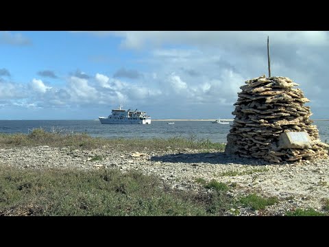
The Abrolhos Lighthouse is located on the Ilha de Santa Bárbara in the Abrolhos Archipelago, off the southern coast of Bahia state in northeast Brazil. The lighthouse was built in 1861 and features a cylindrical tower with a double balcony and lantern, standing at a height of 22 feet. The tower is painted with white and black horizontal bands, and its focal height is 60 meters. The lighthouse has a range of 51 nautical miles and a characteristic of flashing white every 6 seconds.
The Abrolhos Archipelago is a group of five small islands with coral reefs, and the lighthouse plays a crucial role in warning ships of the dangers in the area. The archipelago's name comes from the Portuguese word "abrolho," meaning "open your eyes," which refers to the submerged sandbanks and rocks that pose a threat to shipping. The area has a rich history, with the islands being surveyed by Baron Roussin and later visited by Charles Darwin during the second survey voyage of HMS Beagle in 1832.
The Abrolhos Lighthouse is still in operation today, and its history is closely tied to the history of the Abrolhos Archipelago. The area was used by the Royal Navy during the First World War, and the archipelago is now uninhabited, with the Brazilian Navy responsible for its administration. The lighthouse remains an important aid to navigation, and its unique features and rich history make it a notable landmark in the region.
Light and tower
The light has a focal height of 60 metres. The light has a range of 51 nautical miles. The NGA list of lights numbers it 18200. The Admiralty list of lights numbers it G0306.
Videos
Details
- Range Nm
- 51
- Nga Number
- 18200
- Year Built
- 1861
- Description
- The '''Abrolhos Archipelago''' () are a group of 5 small islands with coral reefs off the southern coast of Bahia state in the northeast of Brazil, between 17º25’—18º09’ S and 38º33’—39º05’ W. Caravelas is the nearest town. Their name comes from the ("Abre Olhos" meaning: Open your eyes), a rock awash or submerged sandbank that is a danger to ships. There is a conspicuous shipwreck in the group, SS Rosalinda.
- Focal Height M
- 60
- Tower Height M
- 22
- Admiralty Number
- G0306