Cabo Prior
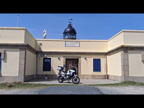
Cabo Prior has a focal height of 107 metres, a tower height of 8 metres and a range of 22 nautical miles. It was built in 1853.
- Focal height
- 107 metres
- Tower height
- 8 metres
- Range
- 22 nautical miles
- Built
- 1853
- Coordinates
- 43.56761, -8.31453

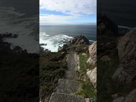
The Cabo Prior Lighthouse is located in the Province of A Coruña, Galicia, Spain. It was built in 1853 and stands at a height of 8 meters, with a focal height of 107 meters. The lighthouse is situated on a high coastal clifftop, approximately 14 kilometers northwest of Ferrol, and features a set of steps descending to a viewpoint overlooking the Atlantic Ocean.
The lighthouse has a range of 22 nautical miles and is currently managed by the Ferrol Port Authority. The structure is still active and plays an important role in navigation. The area surrounding the lighthouse has been recognized for its significance since ancient times, with classical geographers such as Strabo taking notice of the granite protuberance off the northwesternmost point of the Iberian Peninsula.
The Cabo Prior Lighthouse has a rich history, with the site being used as a reference point for the end of the Iberian Peninsula in the Atlantic Ocean since Roman times. The location was well regarded by mariners, including Phoenician and Roman sailors, due to its strategic position. Today, the lighthouse remains an important navigational aid, and its location is still used by the Spanish Navy and marked on modern maps.
Light and tower
It lies on the Atlantic. The light has a focal height of 107 metres. The light has a range of 22 nautical miles. It is managed by Ferrol Port Authority.
Videos
Details
- Name
- Cabo Prior Lighthouse
- Range Nm
- 22
- Year Built
- 1853
- Body Of Water
- Atlantic
- Image Caption
- Cabo Prior Lighthouse in 2017
- Location Text
- [[Province of A Coruña]], [[Galicia (Spain)|Galicia]], [[Spain]]
- Focal Height M
- 107
- Managing Agent
- Ferrol Port Authority
- Tower Height M
- 8