Cape St. Francis Light
Cape St. Francis Light has a focal height of 29 metres, a tower height of 3 metres and a range of 15 nautical miles. It was built in 1957.
- Focal height
- 29 metres
- Tower height
- 3 metres
- Range
- 15 nautical miles
- Built
- 1957
- Coordinates
- 47.80878, -52.78669
Cape St. Francis is a headland located on the Avalon Peninsula of the island of Newfoundland in the Canadian province of Newfoundland and Labrador. The cape marks the boundary of Conception Bay and is also designated as the southern extremity of the Labrador Sea by the International Maritime Organization. A lighthouse was first built at Cape St. Francis in 1877, with the current structure being lit in 1957.
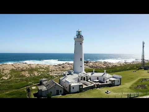
The lighthouse at Cape St. Francis is a concrete building with a distinctive white color and a broad vertical stripe. It features a lantern atop a 1-storey fog signal building, and the fog signal emits one blast every 30 seconds. The lighthouse is an important aid to navigation for mariners in the area, helping to guide them through the waters of Conception Bay and the Labrador Sea.
The area surrounding Cape St. Francis is known for its natural beauty, with nearby coves and bays offering scenic views and interesting geological formations. The cape and its lighthouse have played an important role in the maritime history of the region, and continue to be an important part of the local landscape and identity. Today, the lighthouse at Cape St. Francis remains an active aid to navigation, helping to ensure the safety of mariners in the area.
Light and tower
The light has a focal height of 29 metres. The light has a range of 15 nautical miles. The NGA list of lights numbers it 1844. The Admiralty list of lights numbers it H0468.
Videos
Details
- Range Nm
- 15
- Nga Number
- 1844
- Year Built
- 1957
- Description
- #REDIRECT Cape St. Francis (Newfoundland and Labrador)
- Focal Height M
- 29
- Tower Height M
- 3
- Admiralty Number
- H0468