Lajes das Flores
- Coordinates
- 39.37806, -31.17417
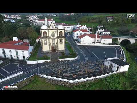
Lajes das Flores is a civil parish and municipal seat located on the island of Flores in the Azores. The parish was established in 1510, with the town being founded in a sheltered bay, making it the oldest settlement in the Western Group with this status. By 1515, the settlement had been elevated to the status of vila by the Portuguese government, responsible for administering the south and western portions of the island.
The village of Lajes das Flores was founded in a strategic location, protected from westerly winds, and facilitated the easy disembarkation of goods and provisions. The area initially included several settlements, including Ribeira da Silva, Fajã Grande, and Lajedo, among others. The parish has a total area of 18.79 km² and an elevation of 67 meters. As of 2021, the population of Lajes das Flores was 562.
The history of Lajes das Flores is closely tied to the discovery of the island of Flores in 1452 by Diogo de Teive and his son João de Teive. The captaincy of the island was later ceded to Fernão Teles de Mensese and eventually donated to João da Fonesca by D. Manuel I in 1504. The parish has a rich history, with the first documented settlement occurring in the 16th century, and has since grown into a significant population center on the island of Flores.
Videos



Details
- Description
- '''Lajes das Flores''' is an Azorean civil parish, and municipal seat of the municipality of Lajes das Flores. The population in 2021 was 562, in an area of 18.79 km2.
- Location Text
- (Lajes das Flores, Lajes das Flores)