Tory Island Lighthouse
Tory Island Lighthouse has a focal height of 40 metres, a tower height of 27 metres and a range of 18 nautical miles. It was built in 1832.
- Focal height
- 40 metres
- Tower height
- 27 metres
- Range
- 18 nautical miles
- Built
- 1832
- Coordinates
- 55.273, -8.249

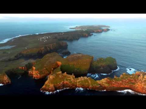
Tory Island is located off the north-west coast of County Donegal in the province of Ulster, Ireland. The island is approximately 5 kilometers long and 1 kilometer wide, with an area of 3.581 square kilometers. It is the most remote inhabited island of Ireland, with a population of 141 people as of 2022. The main spoken language on the island is Irish, although English is also spoken to communicate with visitors.
The island has a unique geography, with steep rocky heights that give it its Irish name, Toraigh. The island is part of the Donegal Gaeltacht, and Ulster Irish is the main Irish dialect in use. There is a lighthouse on the island, although the exact year it was built is not specified. The island has a rich history and is home to several historical landmarks, including one of only two tau crosses left in Ireland.
The Tory Island Lighthouse is a notable feature of the island, although little information is available about its physical features or current status. The island has a website and can be contacted through a specific area code, and it is possible to visit the island to experience its unique culture and stunning natural beauty. Despite the lack of specific information about the lighthouse, Tory Island is a fascinating place with a rich history and a strong sense of community.
Light and tower
It lies on the North Atlantic. The light has a focal height of 40 metres. The light has a range of 18 nautical miles.
Videos

Details
- Range Nm
- 18
- Year Built
- 1832
- Description
- Tory Island has a number of sites connected with historical events and island mythology:
- Body Of Water
- North Atlantic
- Location Text
- Donegal
- Focal Height M
- 40
- Tower Height M
- 27