Fort Aguada
- Coordinates
- 15.49229, 73.77365

Fort Aguada is a 17th-century Portuguese-era fort located on Sinquerim Beach in Goa, India, overlooking the Arabian Sea. The fort was built in 1612 as a defense against the Dutch Empire and was initially used as a reference point for vessels coming from Europe. It is an Archaeological Survey of India (ASI) protected Monument of National Importance in Goa. The fort's name, Aguada, translates to "water" in Portuguese, as it was built near a freshwater spring that provided water supply to passing ships.
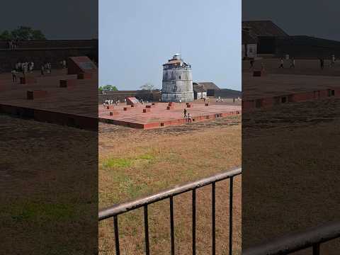
The fort is divided into two segments: the upper part served as a fort and watering station, while the lower part was used as a safe berth for Portuguese ships. The upper part features a moat, underground water storage chamber, gunpowder room, lighthouse, and bastions. The lighthouse at Fort Aguada is one of the oldest in Asia, built in 1864, and was replaced by a new lighthouse in 1976. The fort has a rich history, having been repurposed as a prison during the Salazar Administration, and was once the grandstand of 79 cannons.
Today, Fort Aguada stands as one of the most prized and crucial forts of the Portuguese Empire, strategically located on the mouth of the Mandovi River. It has the capacity to store 2,376,000 gallons of water, one of the largest freshwater storage facilities in Asia at the time of its construction. The fort's unique architecture and historical significance make it an ideal place to visit and explore.
Videos



Details
- Description
- '''Fort Aguada''' is a seventeenth-century Portuguese-era fort, built in 1612, along with a lighthouse, standing in Goa, India, on Sinquerim Beach, overlooking the Arabian Sea. It is an ASI protected Monument of National Importance in Goa.
- Location Text
- Aguada, , Goa