Tanjung Piai Lighthouse
- Coordinates
- 1.25959, 103.50974
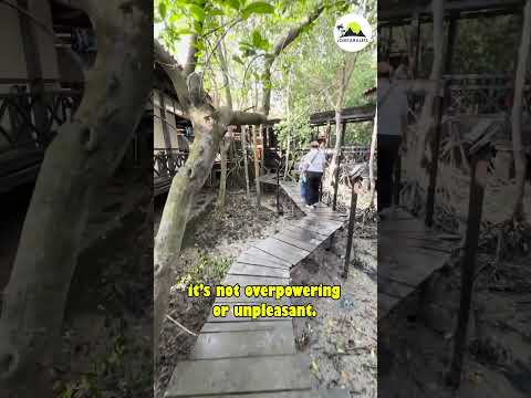
The Tanjung Piai Lighthouse is a 15-meter tall light tower located on the southernmost point of Peninsular Malaysia, making it the most southern point of mainland Eurasia. The lighthouse is situated 0.33 nautical miles south of the point and flashes once every 3 seconds, housing a radar transponder beacon that transmits the Morse code letter "M". The surrounding area features seafood restaurants on wooden jetties, surrounded by a rugged and rarefied coastline of unspoiled mangrove forests.
The Tanjung Piai area is a nationally important icon and a Ramsar site, being one of only five in Malaysia. It is also an important nature site in Johor, being the 3rd designated park of the Johor National Park Corporation. The site attracts ecotourists and has a high socio-economic value for fisheries. It is home to 22 mangrove tree species and is an important habitat for migratory and resident birds, including the IUCN-listed vulnerable species, such as the Lesser Adjutant Stork.
The lighthouse and the surrounding area are protected under the Ramsar Convention, which requires the government and relevant stakeholders to ensure the mangrove ecosystem and its values are maintained. Efforts are made to minimize erosion at the site to safeguard the ecological integrity of the mangrove ecosystem. The Tanjung Piai area is a unique destination that offers a glimpse into the natural beauty and ecological importance of Malaysia's southernmost point.
Videos



Details
- Description
- '''Tanjung Piai''' (Jawi: تنجوڠ ڤياي) is a cape in Pontian District, Johor, Malaysia. It is the southernmost point of Peninsular Malaysia and thus the most southern point of mainland Eurasia. The skyline of Singapore is visible across the Johor Strait from the point. It features seafood restaurants, perched on wooden jetties that are surrounded by a rugged and rarefied coastline of unspoiled mangrove forests.
- Location Text
- Johor