Vila do Porto
- Coordinates
- 36.95678, -25.14119
Vila do Porto is a civil parish located on the island of Santa Maria in the Portuguese autonomous region of Azores. It is the southernmost and easternmost parish in the archipelago of Azores. The parish has a total area of 25.55 square kilometers and an elevation of 107 meters.
The parish of Vila do Porto was discovered by Diogo Silves, and Friar Gonçalo Velho Cabral, a noble in the House of Henry the Navigator, arrived at Santa Maria in 1432. The settlement of Vila do Porto began in 1439, after the original beachhead in Praia dos Lobos, and it was the seat of the first captaincy of the islands of the Azores.
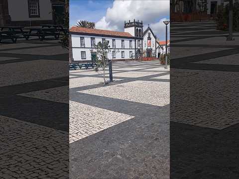
Today, Vila do Porto is a thriving parish with a population of 3119 people, according to the 2011 census. The parish is known for its historic buildings, including the Church of Nossa Senhora da Assunção, and its stunning natural scenery. Despite its rich history, there is no information available about a lighthouse in Vila do Porto, suggesting that the parish may not be home to a notable lighthouse.
Videos


Details
- Description
- '''Vila do Porto''' () is a civil parish in the municipality of Vila do Porto, located on the island of Santa Maria, in the Portuguese autonomous region of Azores. It is the southernmost and easternmost parish in the archipelago of Azores. The population in 2011 was 3,119, in an area of 25.55 km².
- Location Text
- (Vila do Porto, Vila do Porto)